Canal Basin Park
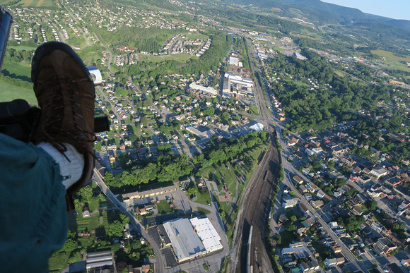
This picture looks west from Canal Basin Park in Hollidaysburg, the eastern terminus of the APRR. Blair Gap is visible in the top right of the picture.
- The park is the green triangle in the center foreground.
- The Juniata River flows under the line of trees that crosses the picture left to right from just under my foot, so the canal would have arrived from the left, parallel to the river.
- The tracks of the APRR extended from the river into the distance along what is now railroad tracks. We'll be flying over those.
- The basin itself - with its associated warehouses and docks - covered the park, the railroad yard, the white-roofed warehouse in the foreground, and much else below us.