GPS Track
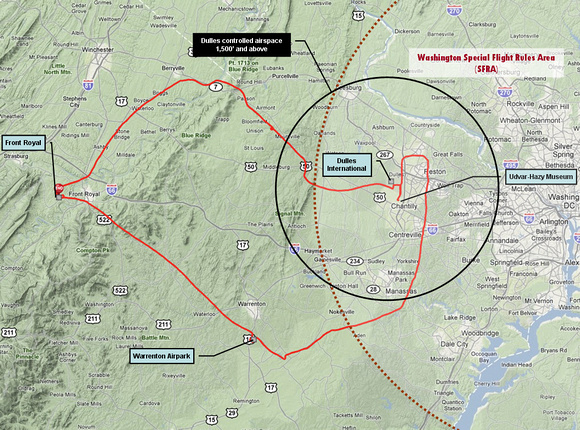
Here's the day's flying from my GPS as rendered on Everytrail. As you see, I had to cross the mountains to join Tom at the Warrenton Airpark and then rendez-vous with Chuck a few miles further on.
The wind was gently from the south, so Dulles was landing planes to the south. That's why they routed us so far east in a big rectangle over Centreville and Reston.
Notice that we're dealing with TWO control regimes. The large red circle is the Washington SFRA. To get in, you need to have taken an online course, file a special flight plan, and be squawking a special code on your transponder (thank you, Chuck for handling that duty for our flight of three). The black circle is normal Dulles controlled airspace, where they tell you where to fly. More radio talk (thank you, Chuck).