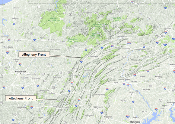
The Allegheny Front
You would think, looking at this map, that the difficult country for the canal builders would be the ridge-and-valley system in the middle of the state, but not so. Those ridges are all cut by rivers. Dig your canal alongside a river and you can twist your way west.
But that works only until you reach the Eastern Divide at the Allegheny Front.
The Front is the eastern edge of the huge Allegheny Plateau, which covers everything in this picture west of the Front and on into Ohio. The Plateau rises to the east, where it cuts off sharply in an escarpment called the Allegheny Front. This edge has always been an obstacle to anyone building a way west, whether canal, railroad, or interstate highway.