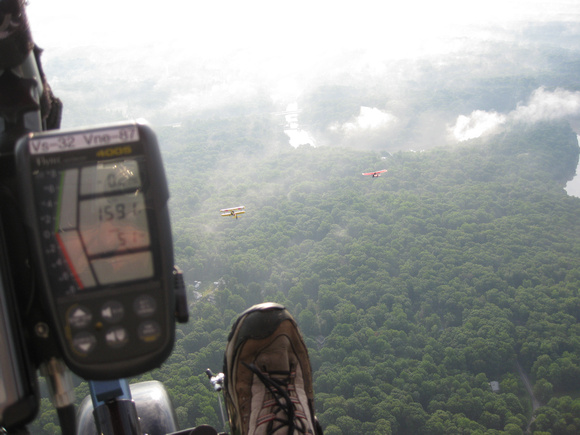
Low over the Occoquan
That's the upper dam on the Occoquan River coming up, so now I know where I am. But not where I'm going - other than that we will be making a big loop around to the east, heading for runway 19Left in a rectangular pattern with left-hand turns.
I'm not real comfortable flying over all these trees at such a low altitude (1,591 feet above sea level - probably 1,300' above ground). Indeed, as you'll see when we get over Centreville and Reston, there aren't many emergency landing fields there, either. Later, Chuck said that since we were at 1,500', the controllers told him to just stay there. So it was by direction. But we're still too low for comfort over this forest. I see that I have unconsciously climbed up above the other guys just out of nervousness.