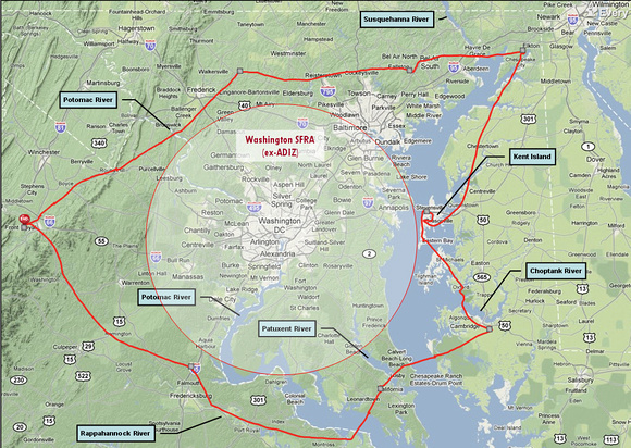
I'd flown the mountains, now it was time to fly the "Eastern Shore" of the Chesapeake Bay, land of a thousand inlets and a million yachts.
But you can't fly there directly, right over Washington. Legally, you can't fly there without more radio gear than I have (a transponder). And prudently, it would be a dumb place to fly: too many houses, no place to land, too many jetliners.
So I flew around it, clockwise - 5-1/2 hours to Kent Island at the eastern end of the Bay Bridge. 5-1/2 hours back around the south.
To zoom in on this map, see the
interactive EasyTrail version. The
aeronautical chart shows all the many restricted areas in addition to the big circle.